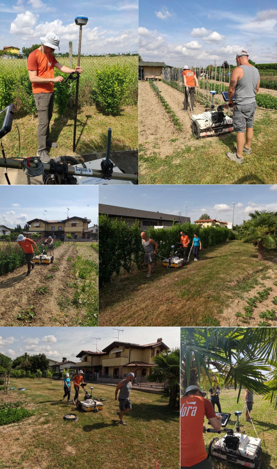
3D Georadar data acquisition was performed in the vacant area located south of the archaeological area on May 24, 2022.
A GNSS ( Global Navigation Satellite System) receiver was used for GPS positioning, connected via GPRS (General Packet Radio Service) to the NRTK (Network Realtime Kinematic Satellite) differential real-time corrections network. The GNSS receiver was installed directly on the Georadar apparatus.
Georeferencing was performed in the WGS84 coordinate system UTM33N zone thanks to the in situ topographic survey of some evidences in the area.
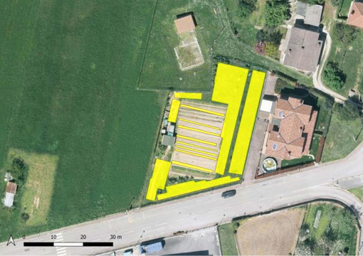
The purpose of the survey was to identify the presence of additional masonry structures belonging to the villa in the only area for now that can be traversed with Georadar.
In fact, the archaeological area is surrounded by land belonging to private individuals, some of which is built-up and difficult to traverse with this instrumentation.
The same area covered by prospecting had a number of problems, related to the presence of areas planted with vegetable gardens, and a part occupied by some service sheds.
As a result, the particular lay of the land did not allow for complete coverage of the area, covering an area of about 730 square meters.
Parametri utilizzati per il rilevo Georadar
- Frequency Shielded antennas: 400MHz
- Total antenna offset: 0.64m
- Number of channels: 8
- Communication: Ethernet
- Positioning: GPS-RTK and odometer
- Power supply: 12V 45Ah battery
- Spatial sampling interval: 0.08m
- Number of samples per track: 436
- Time window length: 97.26ns
- Vertical stack: 4